Juvenile Crime During the School Year, 2000-2006
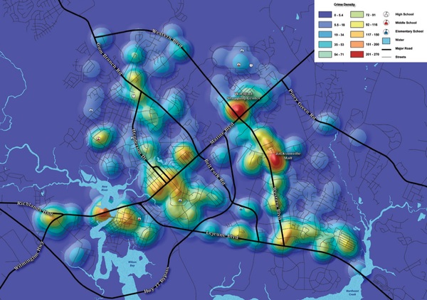
The map was created at the request of the Jacksonville Police Department to show juvenile crime patterns over space and time. Using the city’s criminal geodatabase and ArcGIS, it was possible to query the system for arrests of people younger than 18 and arrests during school days. Organizing the crimes by hour clearly showed patterns in which the bulk of criminal activity occurred during school hours, with some after school, and the least number of crimes occurring in the evening.